
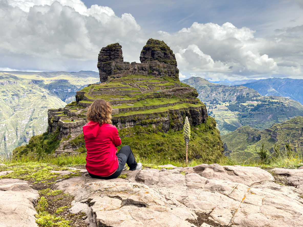
Waqrapukara sits at about 4,300 metres above the Apurimac canyon, in Acos district, Acomayo province, roughly four hours south of Cusco. Two natural rock horns rise from the ridge, and Inca stonework is fitted into the gap between them.
The name is Quechua. Waqra means horn. Pukara means fortress.
The horns are obvious the moment you see it. The fortress is the part worth arguing about.

What you walk to
The approach takes around ninety minutes on foot from the trailhead. You come along a ridge with the canyon dropping away, and for most of that walk you cannot see the site at all.
Then it arrives all at once. Two great stone horns, and beneath them terraces stepping down the slope, and between them walls and doorways that were clearly built with care rather than haste.
The first thing most people say is that it looks like it grew there. That is not an accident. The builders worked with the shape of the rock instead of imposing a plan on it, which is a habit that runs through Inca architecture and is unusually visible here.
The fortress that does not look like one
Here is the thing that makes this site interesting, and almost nobody writing about it says so.
If you wanted to build a fortress, you would build thick walls, a restricted approach, somewhere to store water and food, and a clear field of view over anyone coming. Waqrapukara has the position for it. What it does not obviously have is the rest.
What it does have is fine masonry, trapezoidal niches and double jamb doorways. That last detail matters. In Inca building, a doorway with two recessed frames is a marker of importance. You find them at sites associated with ritual and with high status, not at ordinary defensive outposts.
So the architecture suggests a ceremonial place. The name suggests a stronghold. Both cannot be entirely right.
The most likely answer is that it was more than one thing across its life, and that the name we use came later than the building. Sites in this region were often occupied, abandoned, and taken over again by whoever came next.
We do not tell travellers we have solved this. We tell them to look at the doorways and decide what they think.

Who built it
The usual account is that Waqrapukara began with the Canas people, who lived in this part of the southern Cusco region before the Inca expansion, and that the Inca later took the site and rebuilt in their own style.
That reading fits what you see. Some of the stonework is rough and looks older. Some of it is the fitted, deliberate masonry that the Inca are known for. The two do not match, and standing there you can pick out where one gives way to the other.
Written records are thin. The Spanish chroniclers who described so much of the Cusco region barely mention this place, which is part of why so little is settled about it.
Why it stayed empty for so long
Waqrapukara is under four hours from Cusco and it receives a tiny fraction of the visitors that the Sacred Valley does.
The reason is not mystery. It is the road.
The last part of the drive is rough, the district has little tourism infrastructure, and for years there was no reliable way to reach the trailhead without your own vehicle. A site that is hard to arrive at stays quiet regardless of how good it is.
That is changing slowly. It has not changed yet. On most days you will share the ridge with a handful of people rather than a queue, and that is a large part of why the trek is worth doing now.

Heritage status, and what it asks of you
Peru’s Ministry of Culture declared Waqrapukara a National Cultural Heritage site in 2017.
In practice that means three things when you visit. Stay on the paths that already exist, because the terraces below the horns are original and the ground between them erodes. Do not climb on the structures or move stones. And keep back from the edges, which are unfenced and where the wind is stronger than it looks from the path.
There is currently no entrance ticket. That is unusual for a site of this quality in the Cusco region and it is worth appreciating rather than assuming it will last.
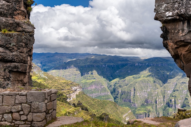
What the trek actually asks of you
Ninety minutes of walking each way, on uneven ground, at 4,300 metres.
There is nothing technical about it. No scrambling, no exposure, no rope. The difficulty is entirely the altitude, and the single biggest factor in whether you enjoy the day is how long you have been in Cusco beforehand. Two full days is our minimum and three is better.
Pace matters more than fitness. The travellers who struggle are almost always the ones trying to keep up with someone stronger in the group.
We have written both of those out properly elsewhere. How hard is the Waqrapukara hike covers the altitude in detail, and nine things we tell every traveller covers the practical side.
When to go
May to September is the season. The trail is firm, the canyon usually stays clear, and the light on the horns in the morning is the reason photographers come.
December to March the same path turns slick, cloud sits on the horns for hours, and storms cross open ground quickly. We keep departures limited in those months and say so honestly rather than sending people up into cloud.
If your dates are fixed and they fall in the wet season, come anyway. Bring a waterproof layer and boots with grip, start early, and accept that the view may take an hour to arrive. It usually does.

The short version
Waqrapukara is a stone complex built into a pair of rock horns at 4,300 metres, above the Apurimac canyon, four hours south of Cusco.
Its name means horn fortress. Its double jamb doorways and fine masonry suggest something closer to a temple. It was probably built by the Canas and rebuilt by the Inca, and the record is too thin to be certain about much else.
It has no entrance fee, very few visitors, and ninety minutes of walking between you and it.
Go while it is still quiet.
Planning to actually walk it? Our nine things we tell every traveller covers the practical side.